There’s this feeling you get standing on the highest geographical point in a given area. This inexplicable draw has lured people to the mountains for as long as humans have been around, causing mankind to risk their lives for that experience of being at the summit. Your mind may go to Mt. Everest that uses the bodies of those claimed by the mountain as navigational waypoints, or K2 where, at one point in time, the fatality rate of those attempting to reach the summit was 25%. Many a mountaineer, knowing the risk of a brutal death and never seeing their loved ones again, took these risks head on and summited these mountains, all because of this draw. You might know this feel feeling, I know I do.
I am a long ways from attempting the 7 Summits of the world, instead I have decided for a different, much more palatable goal as someone working a full time job not in the outdoor space and living in the smallest state in New England. This is a quest to reach the tallest natural points in New England! To clarify for those of you who might be hazy on New England geography, this would consist of Maine, New Hampshire, Vermont, Massachusetts, Rhode Island, and Connecticut. New York is not considered New England, and if you ask a resident of either region they will be very quick to remind you of that.
The Summits
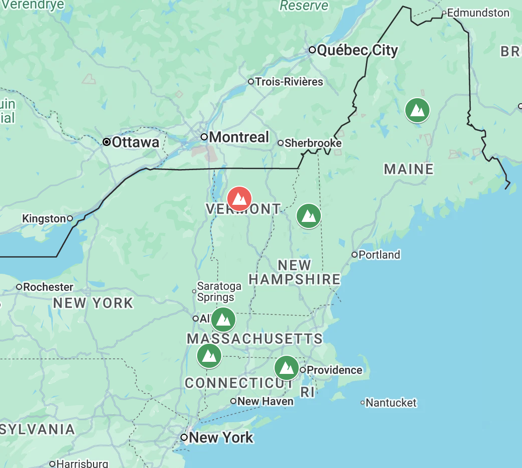
Progress map of the Geographical High Points of New England
You’ll probably be familiar with Mt. Washington in New Hampshire, famous for the worst weather in the world, or Mt. Katahdin, the northern terminus of the Appalachian trail, but the rest of these geographical points are worth a visit as well if you want to add a little adventure into life. So here’s the list with their respective elevations.
Maine - Mt. Katahdin, 5,269ft - Completed 9/15/2026
New Hampshire - Mt. Washington, 6,288ft - Completed 6/23/2025
Vermont - Mt. Mansfield, 4,393ft - Not Completed
Massachusetts - Mt. Greylock, 3,488ft - Completed 10/28/2023
Connecticut - Mt. Frissell, 2,454ft - Completed 8/17/2025
Rhode Island - Jerimoth Hill, 812ft - Completed 7/24/2026
Ghosts of Summits Past
I’ve made good progress with this list, having completed 5 out of the 6 geographical high points already. For those interested in doing something similar, I will list them from my ranking of difficulty and the trails I took to get there. It is very important to note that while hiking is a great way to enjoy the outdoors, it is extremely important that you plan properly, pack the 10 essentials, and research trail and weather conditions ahead of time to keep yourself safe. Despite my opening paragraph, I have no desire to die on a hike due to improper planning, because then I can’t hike anymore, and that would suck.
Jerimoth Hill, Rhode Island, 812ft
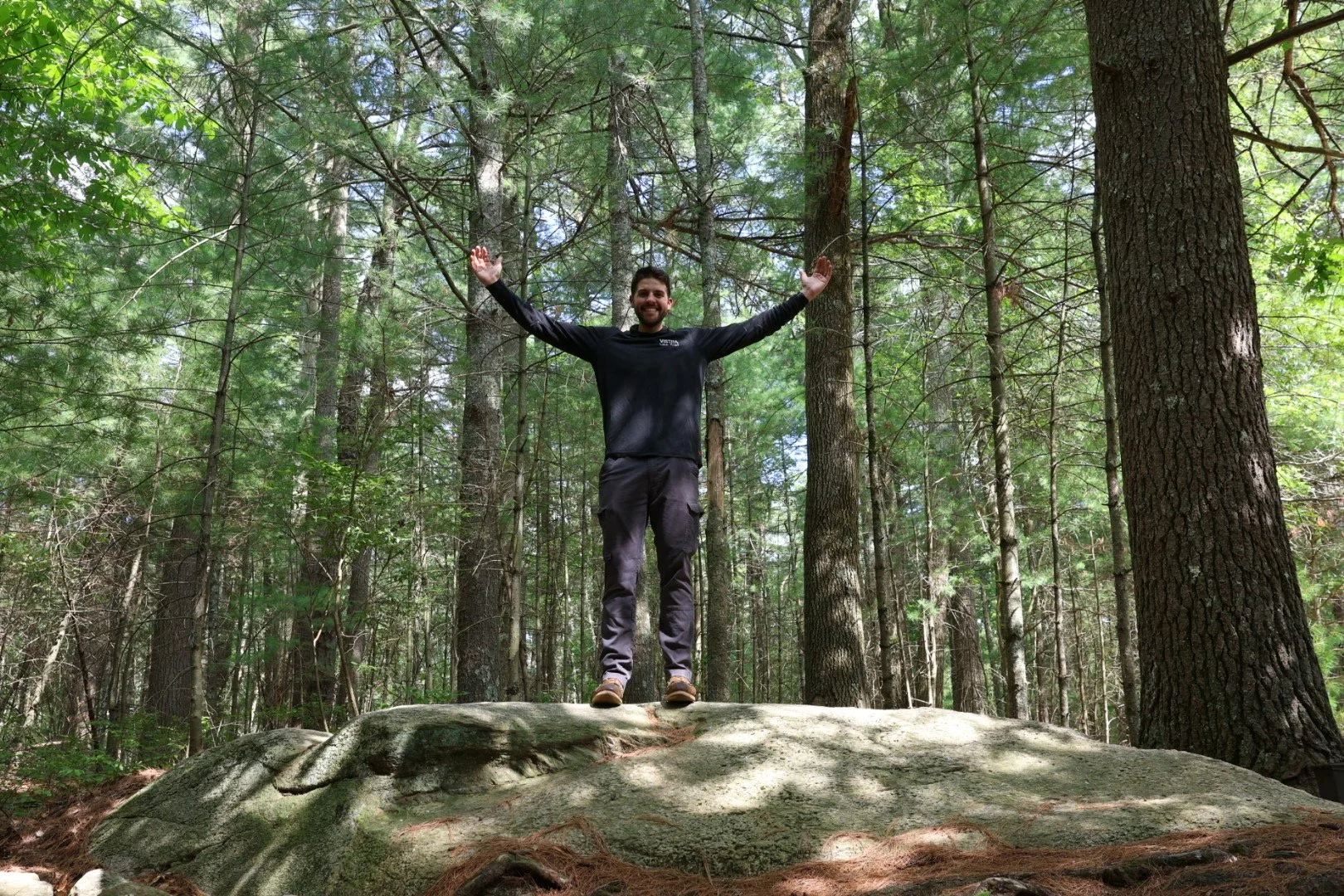
The view from the top of Rhode Island
This is without a doubt the easiest on the list. The Trail to Jerimoth Hill is 0.3 miles out and back, with a total elevation gain of 6’.
The path is a nice managed walking trail from the parking lot just off of Route 101 with side trails to see the benchmarks surveyors used when locating this point. Next to the the “summit” is an ammo box with the official logbook to write your name into the history of those who have dared to make this trek. I completed this point on 7/24/2026 on my drive home from work, so no special gear or clothing is required.
Link to the AllTrails route is here.
Mt. Frissell, Connecticut, 2,454ft
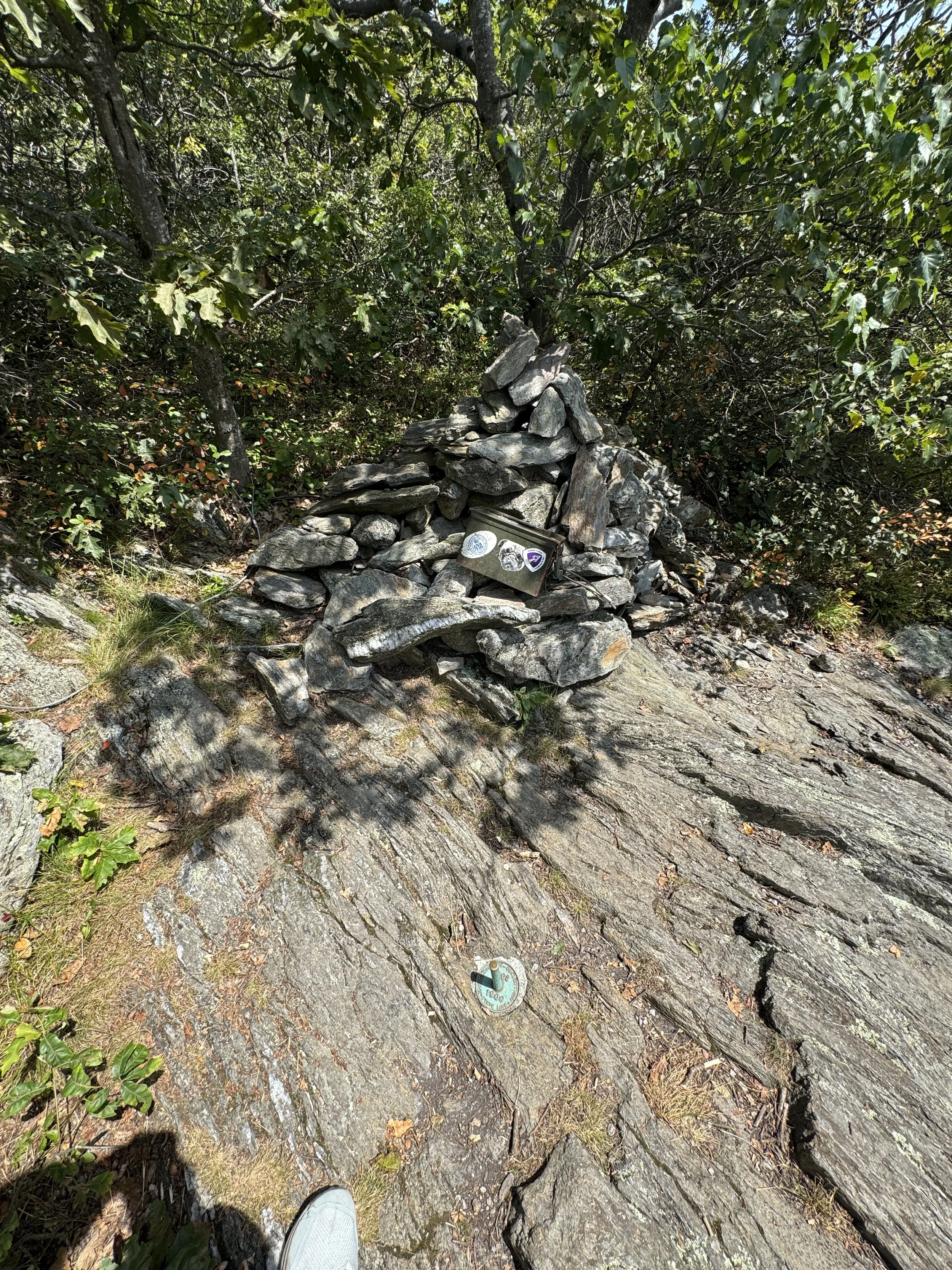
Summit of Mt. Frissell in Connecticut, Highest Point in Connecticut.
Mt. Frissell comes in as the second easiest summit on this list with a 2.5 mile out and back hike with 895ft of elevation gain between you and the summit via the Mount Fissell Trail.
A funny thing about the tallest point of Connecticut is that it’s geographically located on the southern side of a mountain primarily in Massachusetts. The parking lot of this trail is down a long dirt road in Massachusetts where you will start the hike, cross into Connecticut to go over Round Mountain (elevation 2,280ft) and continue along the trial back into Massachusetts, and then cross back over into Connecticut to reach the ammo can with the logbook for this high point.
I hiked this somewhat rocky trail on a toasty August day, so definitely bring plenty of water if you’re going to do the same. If you continue on the trail past the high point of CT, you will arrive at the Tri-State marker of Massachusetts, Connecticut, and New York.
Link to the AllTrails route is here.
Mt. Greylock, Massachusetts, 3,488ft
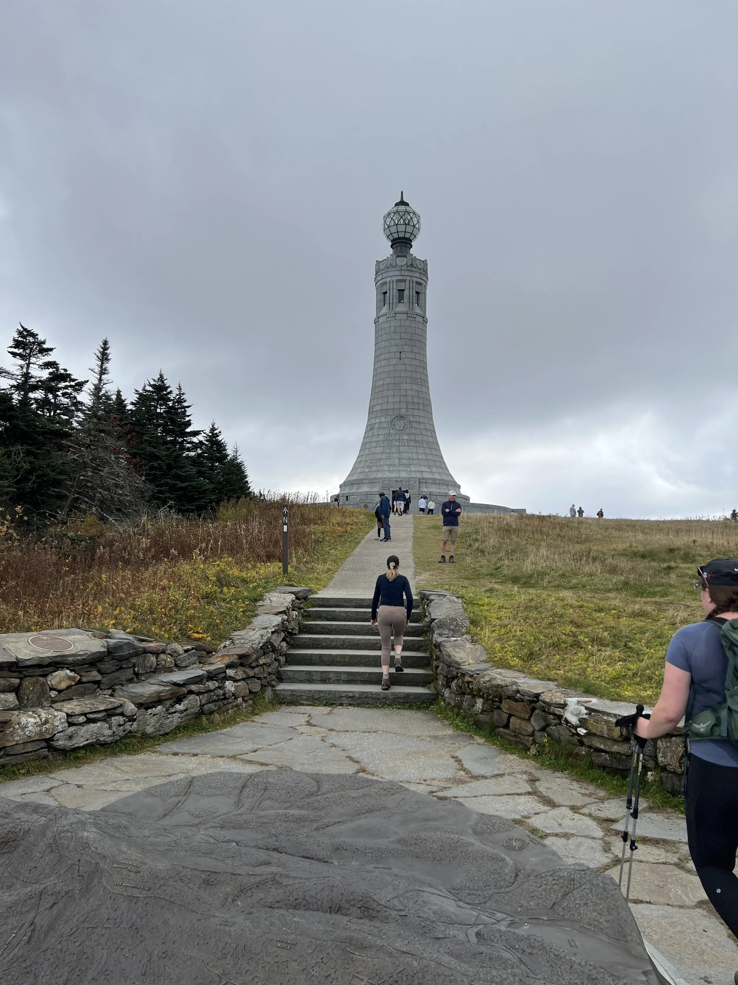
Next up is Mt. Greylock, the tallest point in Massachusetts. We took the Cheshire Harbor Trail, which is 6.5 miles out and back, with 1,925ft of elevation gain along the way. Emily and I did this trail in the fall as part of an anniversary camping trip, and at the time it was the longest hike we had ever done together.
I really enjoyed this hike as the flora completely changes and transitions from deciduous trees to evergreens once you cross Rockwell Road and get on the Appalachian Trail which leads you to the summit. The summit itself is not like others on this list, and features the Veterans War Memorial Tower which resembles a lighthouse. This gives you some cool exploring and plaques to read after you finish lunch at the summit.
Link to the AllTrails route is here.
Mt. Washington, New Hampshire, 6,288ft
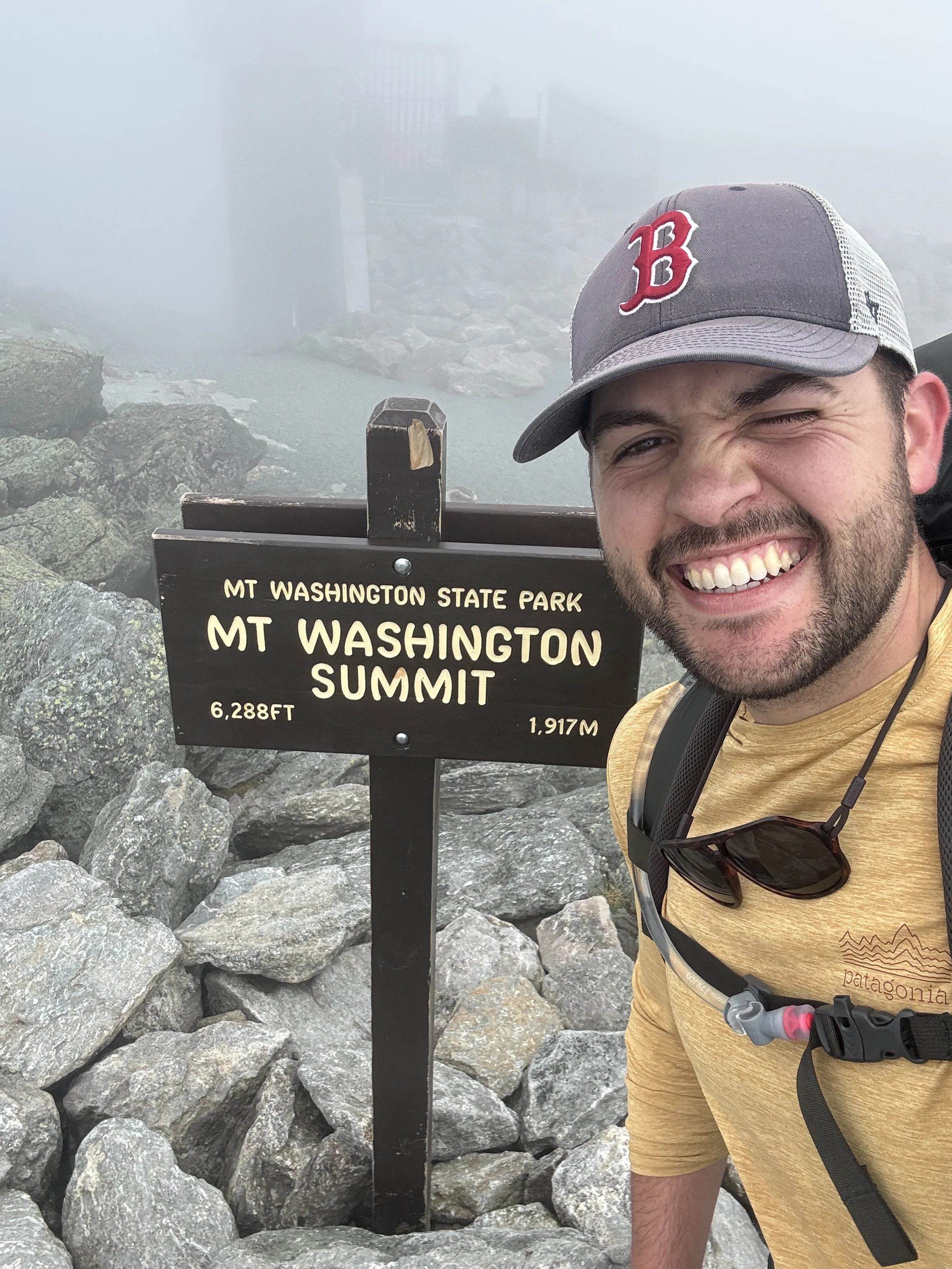
Summit Sign of Mt. Washington, The highest point in New Hampshire.
This might be a hot take, but I rank Mt. Washington below Mt. Katahdin in terms of difficulty based on the route I took and the weather conditions during my hikes. There are tons of different routes you can take to summit Mt. Washington, but if you want feel so inclined to emulate what I did, I took the Ammonoosuc Ravine trail up to the Lake of the Clouds hut managed by the Appalachian Mountain Club, hiked Mt. Monroe, stayed at the hut overnight, and in the morning hiked along Crawford Path to the summit of Mt. Washington, and then descended down the Jewell Trail. This will total out around 10.1 miles and 4,350’ of elevation gain/loss.
As with any mountain, if the conditions are bad, the threat to your wellbeing goes up exponentially, so it’ve very important to plan this hike accordingly. Mt. Washington has claimed lives before, and is home to the worst weather in the world. This summit will take you into New Hampshire’s alpine zone where the extremely delicate landscape is devoid of trees, exposing you entirely to whatever conditions come your way. I went in late June and experienced heavy winds, foggy conditions that reduced visibility greatly on my hike up to the Lake of the Clouds hut, and then experienced perfectly clear and sunny conditions the next day until I made it 300ft away from the summit when clouds and fog blew in again.
Link to the AllTrails route is here.
DO NOT DO THIS HIKE UNLESS YOU ARE PREPARED!
Mt. Katahdin, Maine, 5,269ft
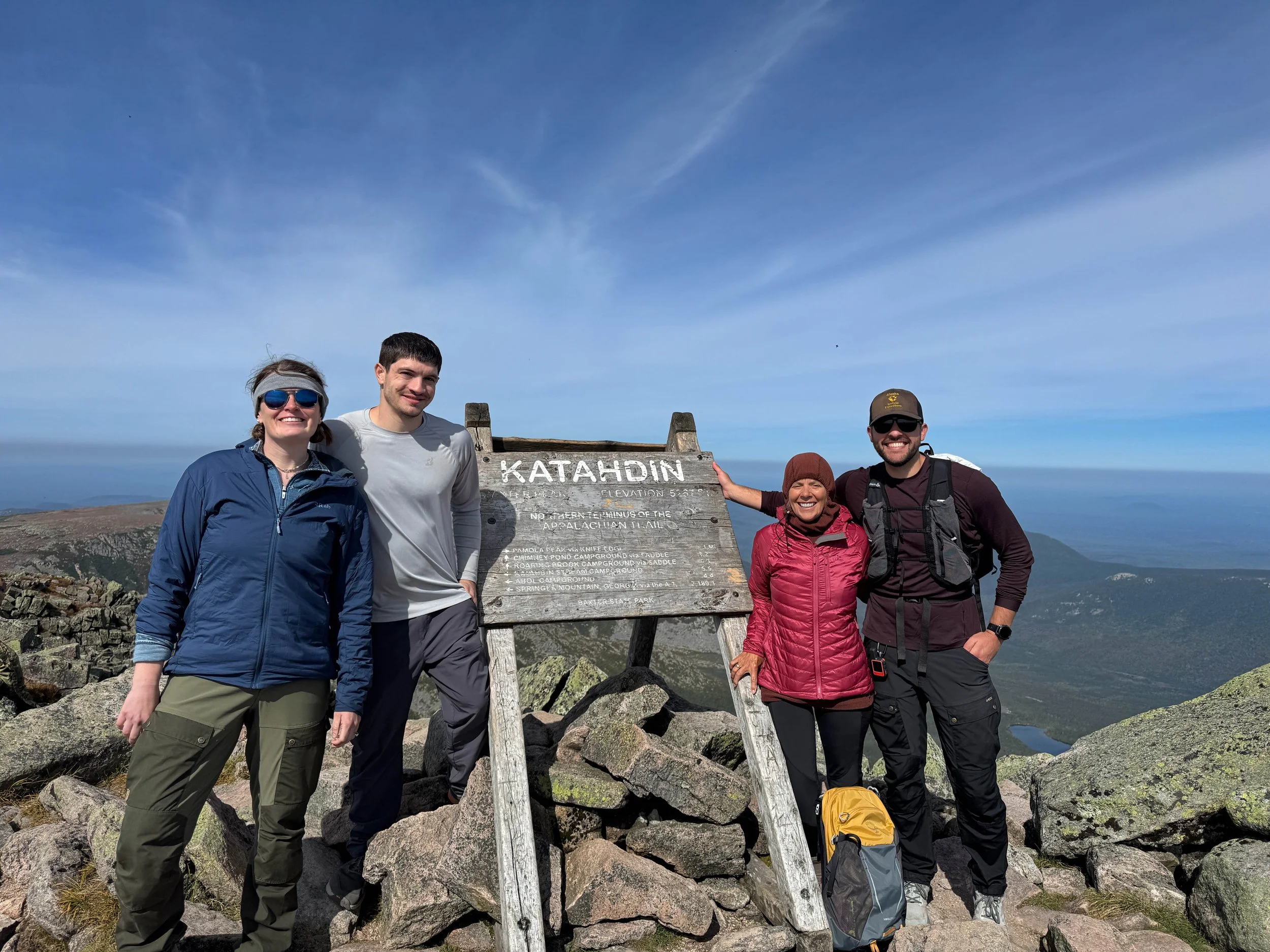
The Frozen 4 on the summit of Katahdin!
Ranking as the most difficult hike amongst the New England High Points comes Mt. Katahdin. This was another adventure split into two days, hiking 3.2 miles with 1,459ft of gain in to Chimney Pond Campground where we stayed the night in a lean-to, and then took the Dudley trail up to Mt. Pamola, crossed the Knife’s Edge on our way Katahdin, and then taking the Saddle Trail back down to Chimney Pond, grabbed our overnight packs, and hiked back out to Roaring Brook via Chimney Pond Trail. This second day resulted in about 10.5 miles and 2,808ft of gain according to my Garmin.
I rank this the most difficult due to the increased difficulty of even getting to the trailhead, and the technicality you encounter on Knife’s Edge with spots of Class 3 scrambling compared to the gradual ascent up to Mt. Washington via the Ammo trail. To me, it’s just so much more apparent that if the weather turns while you’re on trail, you’re completely exposed with no way out except through. The day we hiked in to Chimney Pond there was actually a fatality ultimately due to exposure on the mountain, which we didn’t find out until after our trip had concluded. We were extremely fortunate with sunny skies, low 60’s temperatures and no wind, which made greatly reduced the danger of traversing Knife’s Edge.
The day we hiked in the weather was in the low 50’s with gusts of winds nearing 60mph and overcast skies, making the real-feel temperature close to freezing. We were wearing every layer we brought hanging out in our sleeping bags in the lean-to trying to avoid the cold. I restate my message above, don’t attempt this summit unless you are 100% prepared for what you may encounter.
Link to AllTrails route is here.
That Which Remains
The final mountain summit on my quest for New England’s geographical high points is Mt. Mansfield in Vermont. The summit is at an elevation of 4,293ft, and at this time I have no trip planned to complete this objective of mine. There are a number of trails to chose from, ranging in difficulty and duration. At this point in the year, it’s nearly November and the easy going hiking season has passed, adding to the difficulty of making this hike a reality on a given weekend.
While a winter ascent does sound really exciting and provide the opportunity to finish the high points this year, that is certainly above my current skill level. Between the general risk of hiking alone in winter, spruce traps, exposed ridge line above 3,000ft, and having zero experience hiking mountains in the winter time, it just doesn't seem like a good decision. Like I said above with Mt. Washington and Katahdin, you need to be prepared to do those hikes, and I am listening to my own advice!
What Comes Next?
Fantastic Question. In 2025 Emily and I did a backpacking trip in Utah where we ascended Kings Peak which is the tallest mountain in Utah, but I don’t believe hitting all the high points in the United States will be an intentional goal any time soon.
I have no right to call myself a mountaineer, though I have taken up climbing and pursuing difficult hikes to give myself a baseline of fundamental skills needed to partake in mountaineering endeavors in the future. I’m also learning to ski so that Emily and I can do ski touring trips one day. That’s the greatest part about the outdoors, there are so many ways to enjoy it, and no wrong answers about how to do so.